テ・アラロア
|
Te Araroa
|
|
9 km (Telford Campsite to Lower Wairaki Hut) 3.5 hrs 16 km (Lower Wairaki Hut to Aparima Hut) 5.5 hrs  Left the campsite with Chris at 7.30 AM. The dawn was beautiful with a storm of sandflies. Chris started to embrace them because it was the only way to beat them according to him. The track was very steep from the beginning. Chris was walking in a good speed but didn’t need any intervals until the top. While I was still ascending, he was at the first top of the hill and drying his wet tent.   I caught him up and kept going. The track was now on the ridge line still going up and the final top (500m elevation in total) was a collection of rocks. It was pretty windy and I was too scared to stay.  I called Chris a few times but couldn’t find him ever since I saw him walking behind me on the ridge. I went into the bush and started descending, hoping he hadn’t been blown away with his tent like paragliding. It was a steep down hill maybe for about half an hour. Then it became an easy track. I took a break at 3 hour-point. There was Sebastian, a German guy who’s doing South Bound and almost finishing the trail walking to me. He told me about two aggressive hawks attacking walkers at just 5 mins away from where we were. He was almost getting a scar on his head he said. Chris caught up after his nice breakfast on the ridge line and we said bye wishing best of luck for Sebastian. Soon after, we heard the loud alert noise from the haws. Chris was walking in front. As soon as the haws knew that we are not walking off their territory (we assume they are a couple breeding chicks in the nest somewhere on the tree nearby), their attacks started. I put my wooden walking stick swinging above my head. But Chris got most of them. Apparently the haws mainly focus on the front one. Glad that I was slow. If you survive the crows Lower Wairaki Hut was right there. 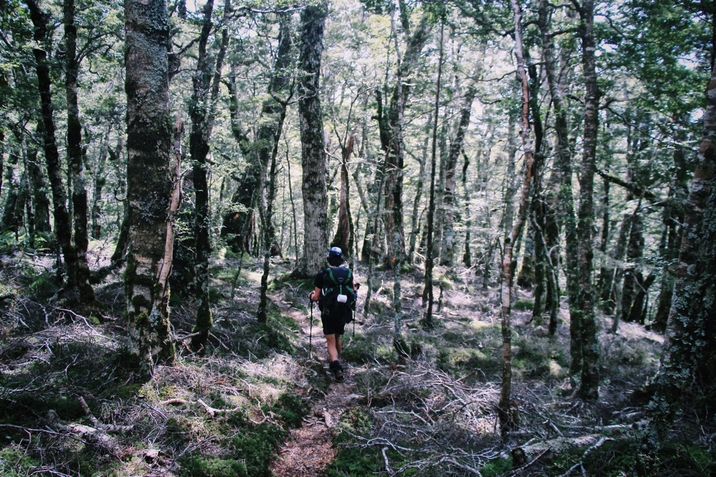 Between Lower Wairaki Hut and Aparima Hut was crucial. There were many streams cutting through the track and we had to go down like 20 meters down to there to cross and go 20 meters up again on the opposite side. We repeated it uncountable times. I was getting slower and a bit annoyed of this track. Chris was already far ahead of me when this frustrating track was ending. The next stage was dodgy wet ground covered by spiky plants. I felt this would also never end. The markers lead me to cross the river and there was a nice swing with the green DoC sign on the side. I really wanted to jump in the river from the swing because it was hot and I was craving for it. But to stay being a good Te Araroa walker I had to waste it. And then I was like “Where is the f***ing Hut!” It was far. You’d expect to find the Hut right after the swing. But there was unexpected short climb and long enough to say a long path to the Hut. I was really disappointed that the river was far enough to give up walking the path to swim. 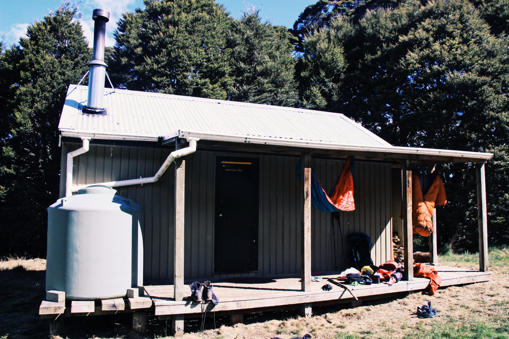 Drying our gears at Aparima Hut There was another TA thru-hiker from Czech Rep, Tom. He was funny and easy to talk to. I encouraged Chris to go for the river swimming together and finally we did it. It was the best thing I’ve done for the year if nothing better is waiting for me this month. Wow, it’s almost the end of the year.
In the Hut when we all were having tea, I said “too much food” watching my food pack. Tom cracked up “I’ve never seen a TA walker like you!” Maybe I’m not a proper one because I don’t suffer from hunger no like the other hikers. I was really full and couldn’t eat anymore while Chris and Tom were still hungry after dinner. I left my Rainbow Flag on the table for Tom to get him sign on and went to sleep. I was seriously toasted that night and kept saying “so hot” in my sleeping bag. Chris was saying that he should do some writing before he sleeps. Tom asked Chris what he had been writing and Chris said “Oh, I haven’t started. I think I should get a pen.” And Tom was like “You guys will definitely stuck in my head for a while. One is full on the trail and hot as wearing sleeping bag and the other one says writing is good who doesn’t even have a pen.” It kinda feels good to be remembered by someone aye! Tom told me a Japanese TA walker that he met in North Island this year. He said the dude was really fast and always chasing after him two days behind while there was only one time that Tom could get one day behind. Tom remembers about him because he suddenly disappeared from the trail and ended up being a DoC warden hahaha His name was “Eiji Kitai”. Hope you see this interesting guy one day!
0 Comments
Birchwood Station to Telford Burn Campsite 11.5 hours 28 km (35 km in total) Woke up around 5 AM before the sunrise. It was still dark outside but the gradual colour change was starting behind the silhouette of the mountain into orange. My head was not clear and aching a bit even though I had enough sleep. I slowly started moving to get up and to cook for breakfast and lunch. 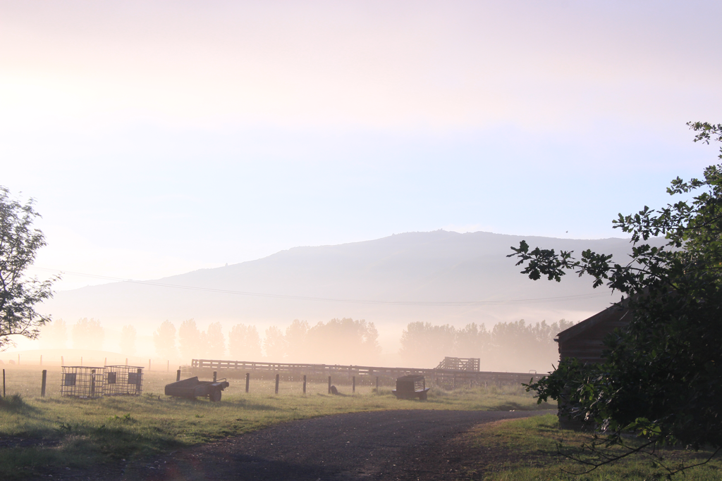 The farm was covered by fogs and the sunshine was very soft as if every single particle of water in the air was reflecting the light in every angle. I remembered the similar scenery that I saw in Hokkaido when I was working for a dairy farm. We started our day at 4.30 AM for milking. When I woke up no matter how much proportion of my brain wasn’t still functioning, got out of my bed, got change in working clothes and walked off the entrance towards the milking shed, my sight got trapped in the purple thick fog in a second. I was still half asleep and for sure my eyes were swollen like a frog but I couldn’t help myself capturing that miracle moment. After I finished working and showed the photo to my boss, he said “I don’t see anything. What were you trying to get?” It was shocking. Apparently for them, it’s just a part of their ordinary life. So I think those people who are working at Birchwood Station must be taking the foggy view as like me watching a group of people hiding only the very private parts of the body with tight fabrics in the night city. Yeah I don’t know how to describe it well. Anyways, to me the fog was beautiful. After I took a shot, I went back to the bed for a short nap toeliminate the headache. It worked very well. So I left the accommodation 6.40 AM. You never know know how long your day is going to be until you face the moment. I was pretty energetic. I passed the bridge over the dirty contaminated river, went through the pine forest and took a guess to the straight along the farm fence after the stile into the farm rather than going to the right. Mistake one was made but I never knew. I kept walking through a sheep paddock with shit tons of spiky annoying grass on a wet dodgy ground. After 20 minutes of the fight I found the first sign and obviously I kept following the one after and another one. I found a stile leading me outside the farmland. It became a pine tree forest and I lost the marker. I heard the river close. I was stuck. 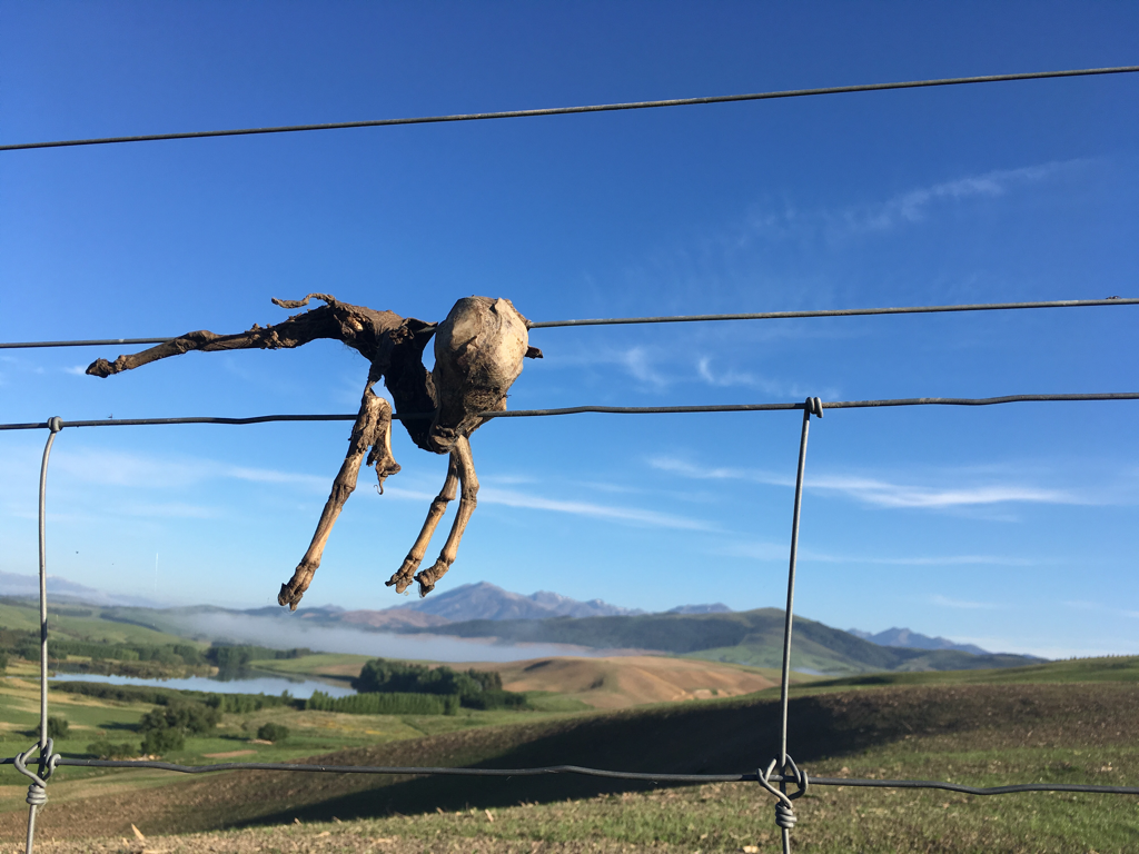 A mummy of a very young lamb that was stuck on the fence. Maybe it tried to jump out of the fence and got electric shock to death or just died due to hunger. Poor one. Don't worry. I didn’t end up being stuck like this poor lamb. I hated doing this but I took my phone out and check my location on GPS with the app called MapToaster. It works offline and accurate so pretty useful to spot your self in bush. The blue dot indicating mylsef on the map was literally 1 km away from Birchwood Station. I was very very sure that I saw the pond which is about 4 or 5 km further up. No way. This GPS is broken. Who said it was accurate and useful huh? And all of the sudden the world turned upside down and black became white and spicy became sweet and my brain became a foot! I screamed. I! Was! Making! A! Loop! Inside! The! Paddock! And! Back! To! The! Same! Stile! Oh man. This is how my life is ending. I was almost crying. I didn’t want to go back the same route that I just walked. I started walking again. Back into the farmland and said second hi to the lamb mummy. I found a new pole over the next paddock but there was no stile around there. So I had to climb over the fence. Mistake No.2 made here. Well, I didn’t know the fence was alive and I got electric shock. Second time in my life. First time was when I was in Hokkaido at the dairy farm, they forgot to tell me about the cable. I threw all my stuff to the other side of the fence and carefully made it. Phew. 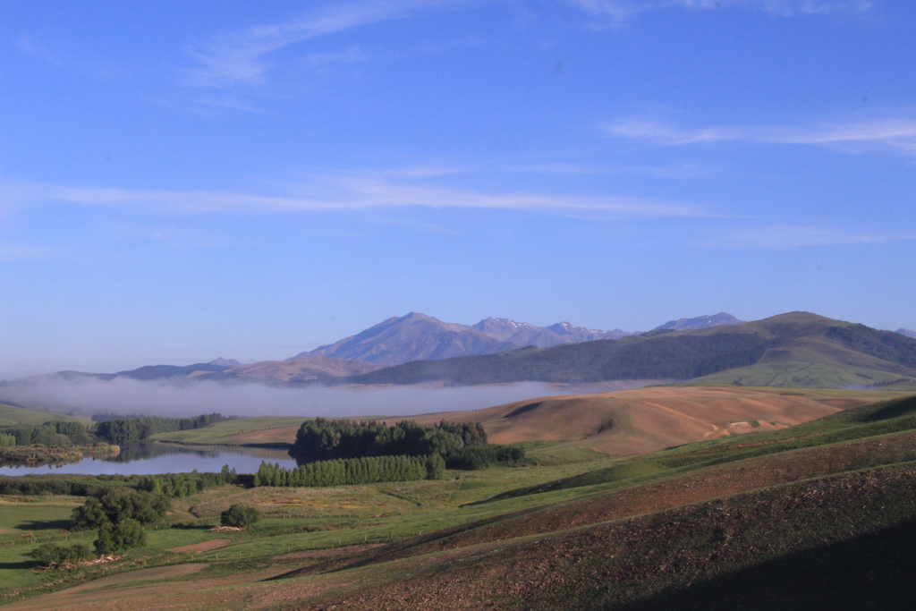 A photo I took just before I got shocked. Ater that, it was fight against muds and spiky evil plants (they were everywhere!) and the heat. Basically, the day was entirely on farmroads without shades. My shoes were wet and my feet started being numb and my thoughts were getting collapsed. 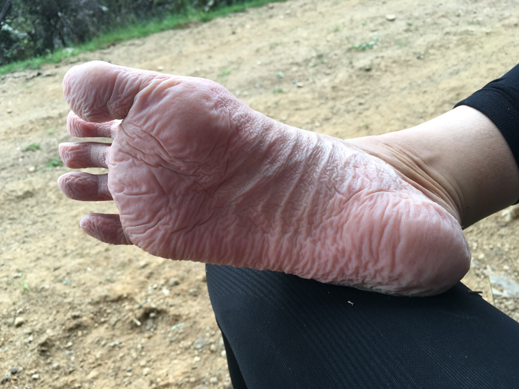 After long hours of walk with wet shoes I found that I can produce another brain. I got lost so many times because the markers were far apart each other where I’m pretty blind without wearing glasses. The reason why I don’t like wearing them when I’m walking is because they slip down a little bit every moment and also they get steamed easily from my own heat. I think I forgot to mention this, the track has been modified here. It used to be 19 km (Struan flat Rd - Telfor Burn Campsite) but now 27 km. But because of many mistakes that I made on the day I had to walk 35 km to get to the destination. Anyways, the track on the shitty farmland which you maybe can’t even call it “tramping” went up and down and up and down. Not very steep but just hot, boring and made me feel like never-ending. Many sheep and cows on the trail and they run away from you making smoggy dusts! They run away only when you are close enough so the dusts are always right in front of you. And they stop running once they make a certain distance and keep doing the same thing. Plus, sometimes the running group gets bigger because this animal tends to be attracted to a movement inside the herd. Cows were a bit more funny than sheep. They liked to follow from distance to curiously observe what this human was doing. And they ran away making dusts too. After I walked the stile over the fence the whole herd started crying so loud. Maybe they were proudly celebrating for “kicking the danger out” from their territory. 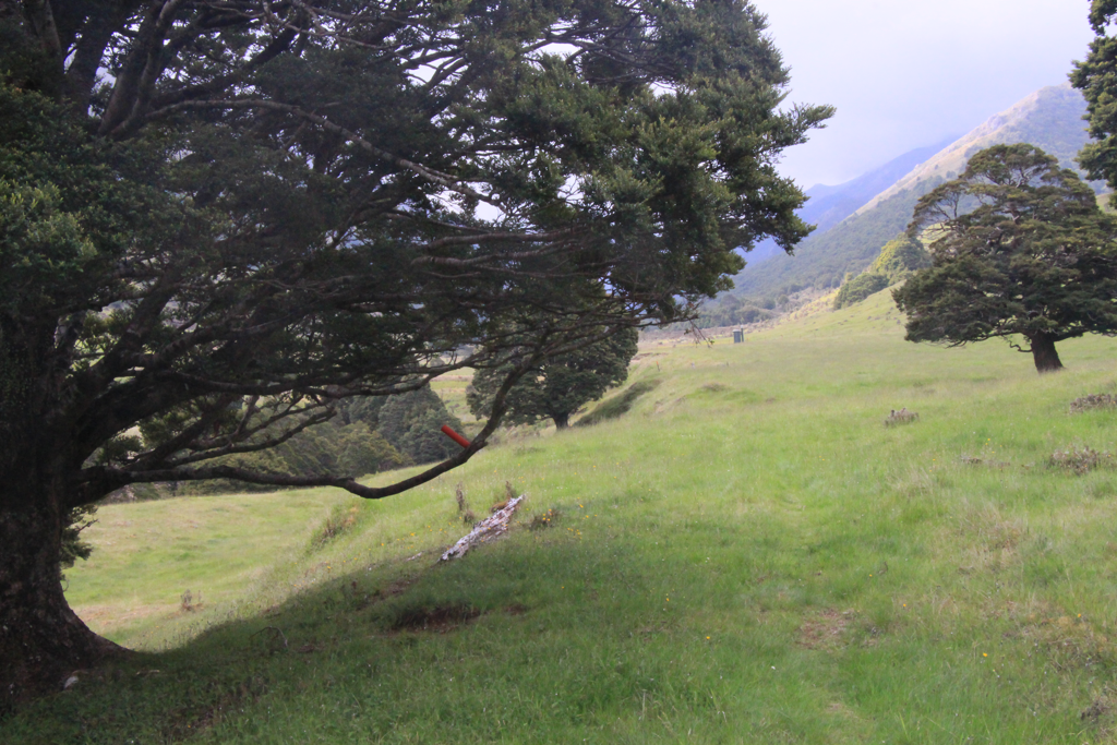 This red marker was nailed on the tree branch. I don’t know how the DoC people came up with the idea like this. They must be very creative. 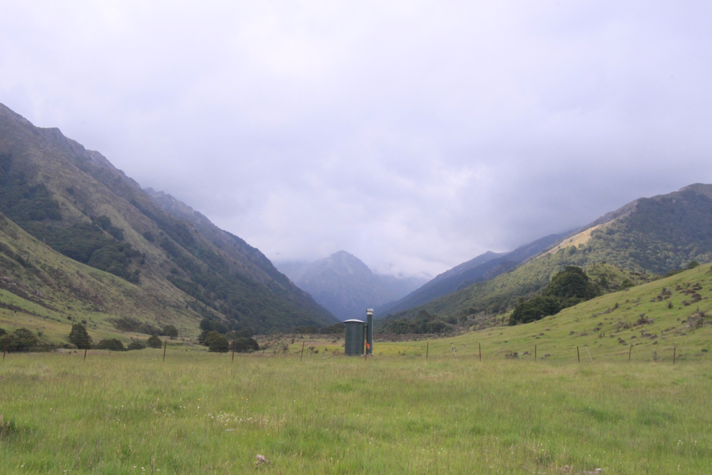 The toilet suddenly appeared at the middle of nowhere. I think this toilet is one of the most beautiful toilets I’ve ever seen. Annoyingly nice view. After 11.5 hours of the farm tour with shits everywhere and farm-polluted rivers, I finally got to Telford Campsite. Speaking about the river, it made me really sad to see those rivers and streams contaminated by lots of farm wastes including antibiotics, animals’ wastes, harmful metals from the fences etc. They must used to be clean as you can safely drink without purifying it. But now they smell, look brown, make me hesitate to drink. I’m not blaming the animals but us creating huge bald farms by chopping down all the trees, bringing too many animals from outside, letting wastes draining into the river which eventually ends up in the ocean, and not even knowing out how to control it. Ignorance and arrogance. Should we think about this system. Why not vegetarianism or veganism? If you care about kiwi birds or any “precious” spieces, why not discussing about farms? New Zealand is making lots of profit out of farm industries. But some decades ago it used to be mining and it shifted to wools and now dairy and pine trees. I think it’s time to stop using up the limited resources from the natural environment and stop cruising around searching something else for the next. Otherwise, they’ll all be gone in the near future. It doesn’t only apply to this country but the other countries as well. I am really concerning how the society has been formed by keeping consuming those resources. Why do we study history yeah? Isn’t it because we need to learn what we’ve done in the past and not to repeat the same mistake or make it worse? 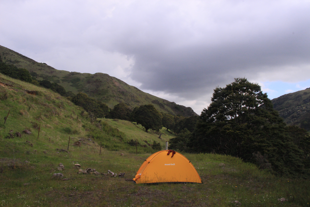 I like Montbell, the outdoor gear brand founded in Japan because they really care about the environment and keep raising their voice out to save our planet. I admire them and feel grateful to get supported by them. Keep it up Montbell! This night, I got an accompany. He’s a crazy guy from Auckland. While I spent eight days to get here, Chris made it in 5 days walking 50+ km everyday. He’s not normal. 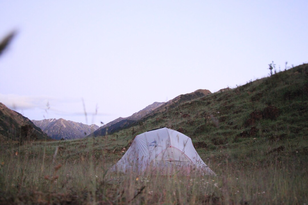 This is his spaceship-like tent. Should call it his base maybe.
Wrote too much. Time to stop and sleep. Bye! 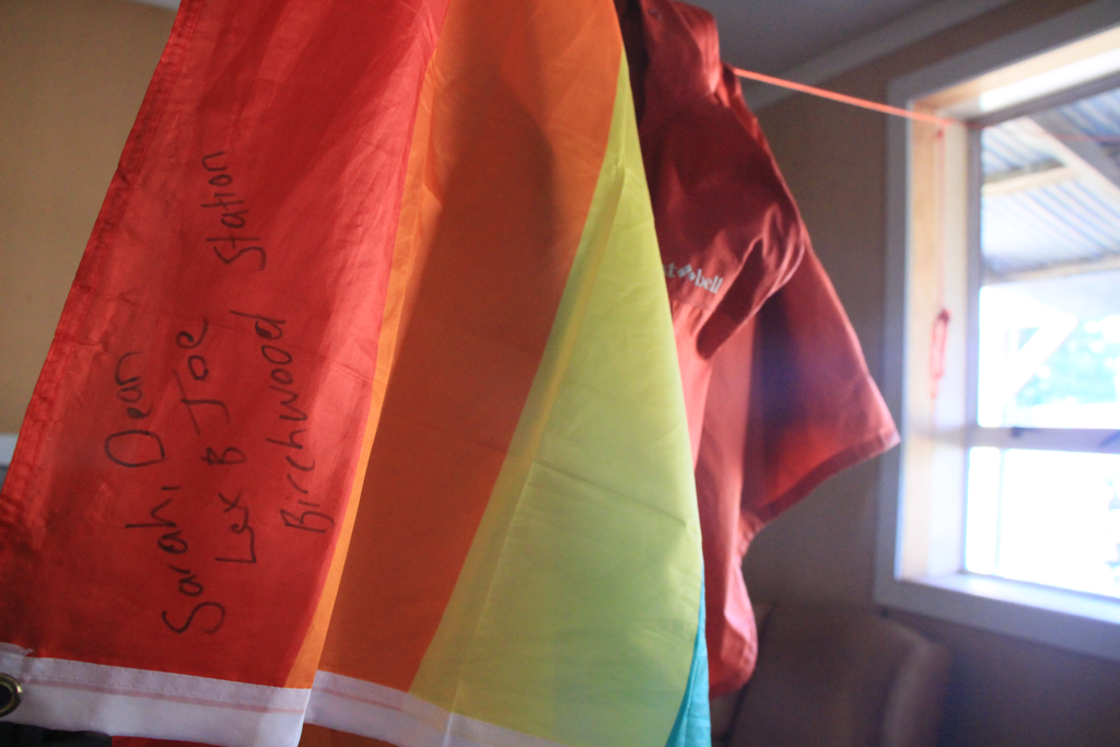 First name on my Rainbow Flag! Thx Birchwood Station! I made the zero day. Literally, zero walk. Shocking. Actually I couldn’t sleep well during the night due to the period pain and uncomfortability of something. I woke up too late to start the trail but still couldn’t even get out of the bed. I ended up spending whole morning in the bed feeling guilty by not contributing moving forward on the trail. As the pain started getting better, I helped out Sarah for cleaning the windows and playing with Lex. It was fun and made me forget the pain for a while. She gave me her heamoglobin pills. More oxygens can be carried in my blood! She cooked me dinner again and I spent zero dollar as well with regard to the zero day, aye. After dinner, it was still light outside so I went out on the road to check out the starting route for the next day. And I saw two Peacocks on the paddock with cows. It’s gonna be a good day tomorrow, I thought. 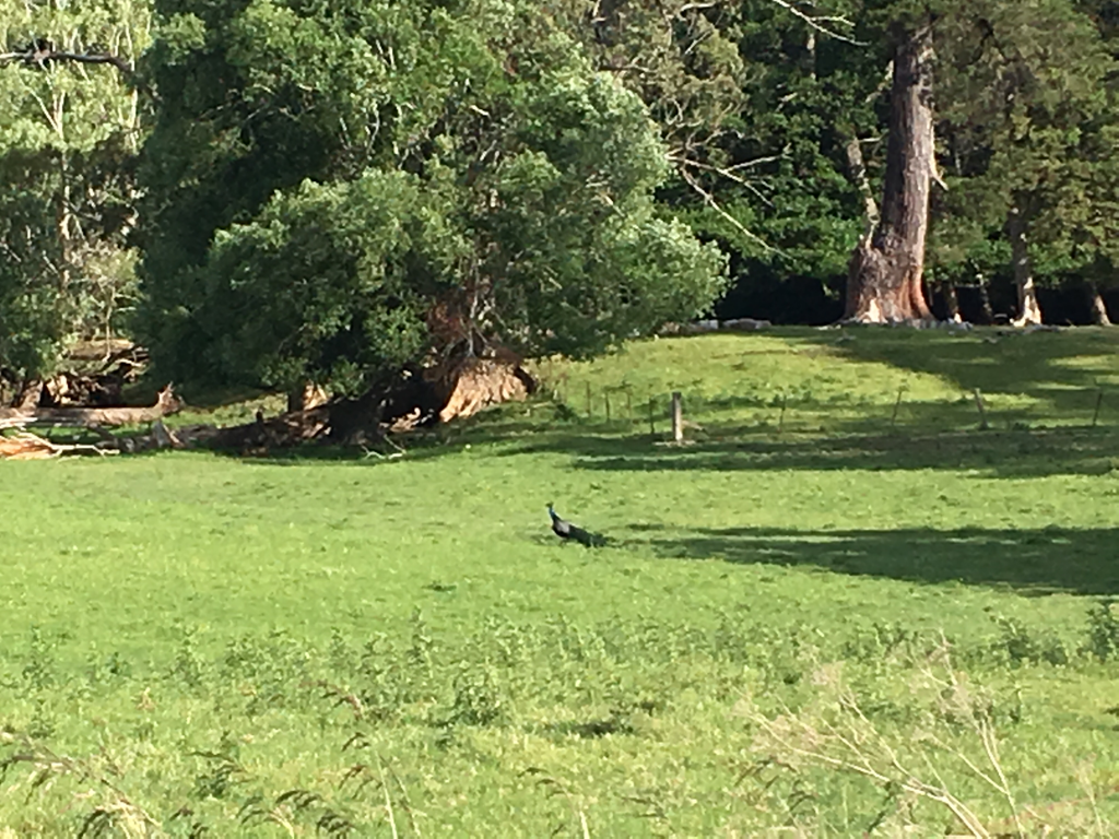 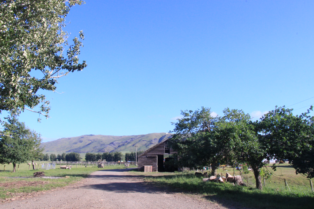 Merriview Hut was amazing with hospitality from Chantel and Dylan and their friendly animals. I would love to visit that Hut agian. If you send them one of your favourite photo that you took on the trail they are going to print it out and put it up in the flame on the Hut’s wall. I’m gonna do that. This morning, I had a bad feeling when I woke up. Yeah bad one, the period. I took my mooncup out from my bag to boil it for hygiene. Insert it, set, I’m ready to go. 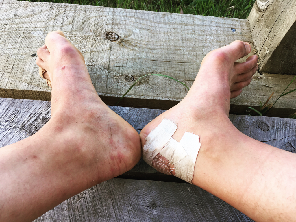 Hello my new friends, blisters I started walking on the road following what the trail note which was written by a Kiwi guy who did North Bound in South Island in 2016. He said there is an animal tunnel so get down there and go through to the right on the farm road. Before the tunnel, I found the DoC Te Araroa sign on the farm fence so I climbed over it through a dense spiky annoying plants area. Kept walking through the farm land and found where the tunnel was. If you are going the same way as me following the official trail, after the stile into the farm you go right and keep walking until you find the tunnel on your left under the road. The farm road went uphill after the tunnel, I found it pretty steep and long, I kept going straight where the white ribbons lead me and continued to the road. It was easy after that. Well, not really for me to be honest. I started getting period crump on my back and tummy, also the old injury on my right thigh started aching bad. I was dragging my legs walking towards Longwood Forest. But my mental was telling me to call out. I was fighting inside myself, “go Wako” beast VS “nah listen to your body Wako” beast. Yeah, they both beasts. I couldn’t make up my mind so I phoned my flatmate Emma who did Central Otago Rail Trail in mid-winter with me for 7 days to ask her an advice. As soon as I said “Hi Emma, I have two options while I’m having pains and shitty feeling...” there was a car coming through the small road which can never know how to be busy. And I said to Emma “I’m gonna hitch.” She doesn’t even know what I’m saying but she said “Go hitch it!” 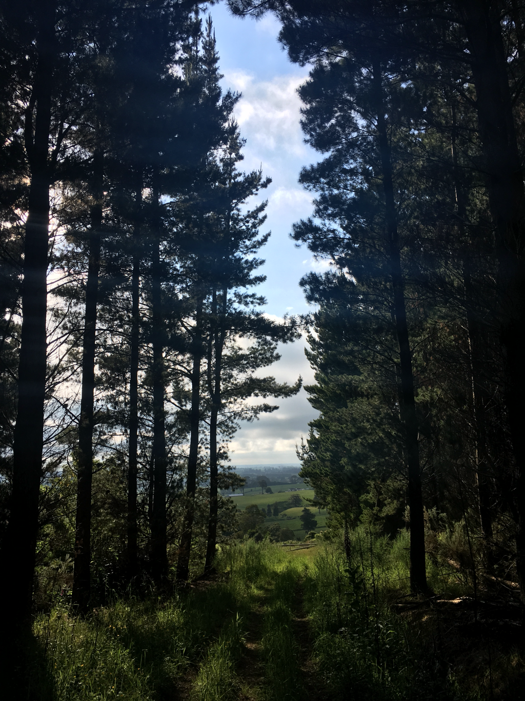 The farmer guy picked me up at 9 km point of the day and that was it. I got straight to the destination in the morning, Birchwood Station. Sarah, the manager of the accommodation was young and powerful mom of one energetic boy and an infant. I think she could be my age but our lives are very different. Sarah has her own family since 5 years ago working as a mom, a wife and a staff while I’m still a student depending on my parents and wandering around without settling at one place. It’s just very different from my life you know. I’m not saying which is right and wrong but imagining me living my life like Sarah is... just wow... that would be cool as well... Anyways, I got really impressed for her. 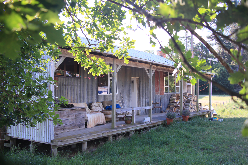 Birchwood Station In the afternoon I helped our Sarah cleaning up her gardens instead of paying the accommodation fee and she even cooked dinner for me. Her kiddo Lex was really cute.
Done for the day. Short and quick which is good. Martin’s Hut to Marrivale Hut 9 hrs 15 min 28.5 km I slept in again! Woke up at 6.50 AM and rushed to leave at 7.40 AM. Steep muddy uphill for 40 min (I’m very slow) to the collection of rocks at the top. 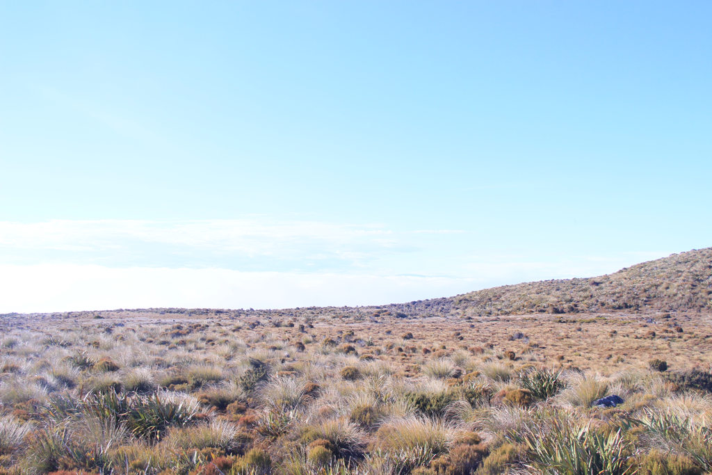 Nice weather. Start follow the poles. Well marked. The ground is soggy and soft. The boots might get soaked. Be mentally prepared, the track is going to be wet, muddy or soft all the way except the gravel roads. 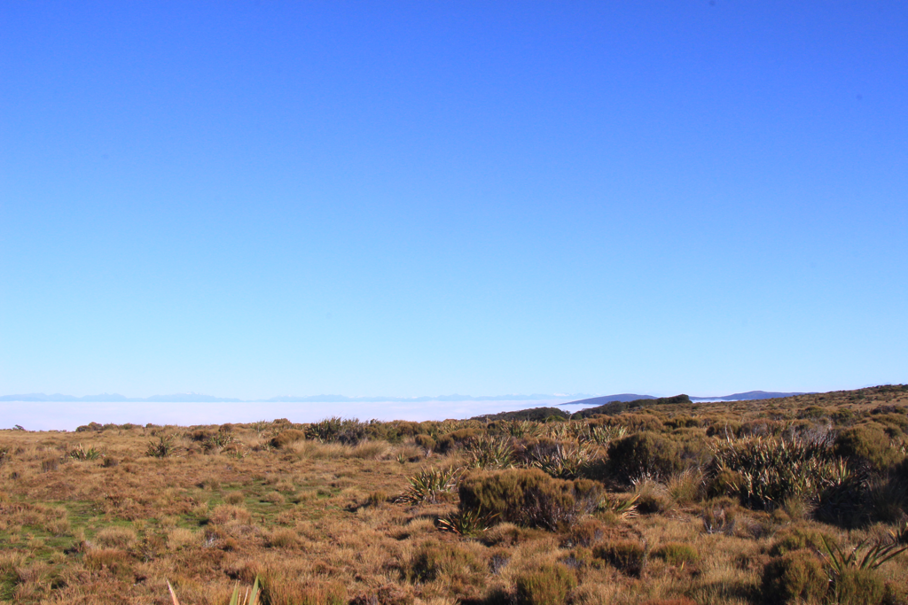 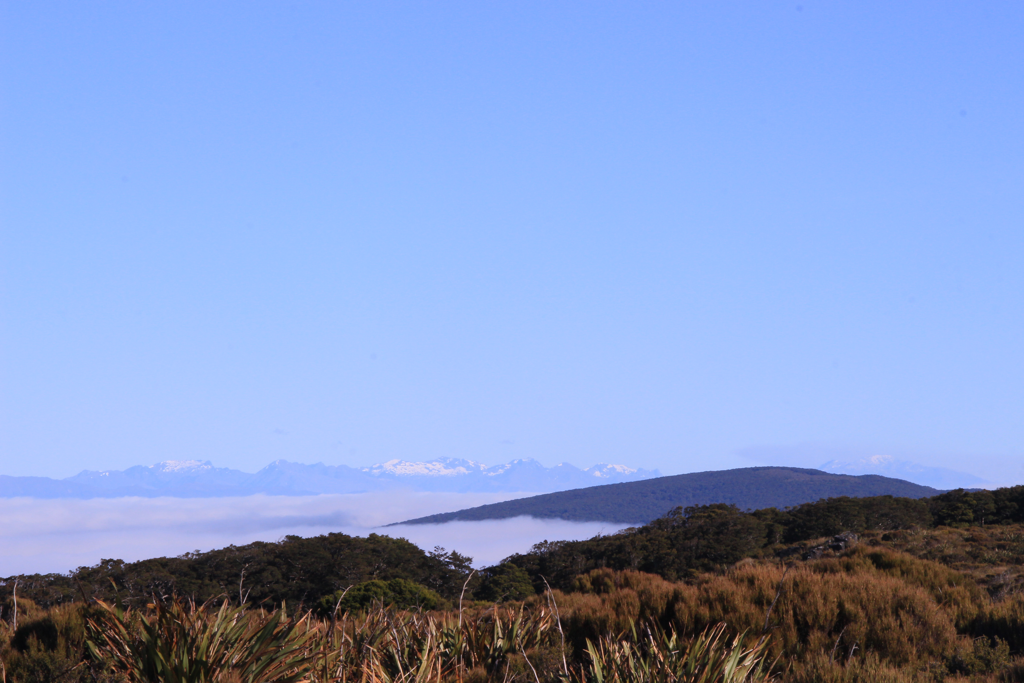 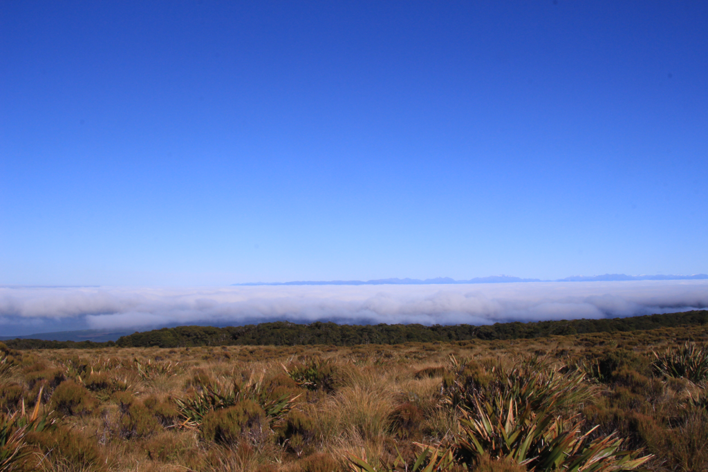 Its only 700 m+ but the clouds were under the mountain deciding ‘us’ and ‘there’. You may be able to see this only in the morning because as the sun started heating the atmosphere the fogs and the clouds get lifted up higher and there won’t be laying under the mountain anymore. Keep following the markets. Fight the muds. Go down through bush and up to the exposed another 700+ peak and down down down in the bush then bump into this white place. 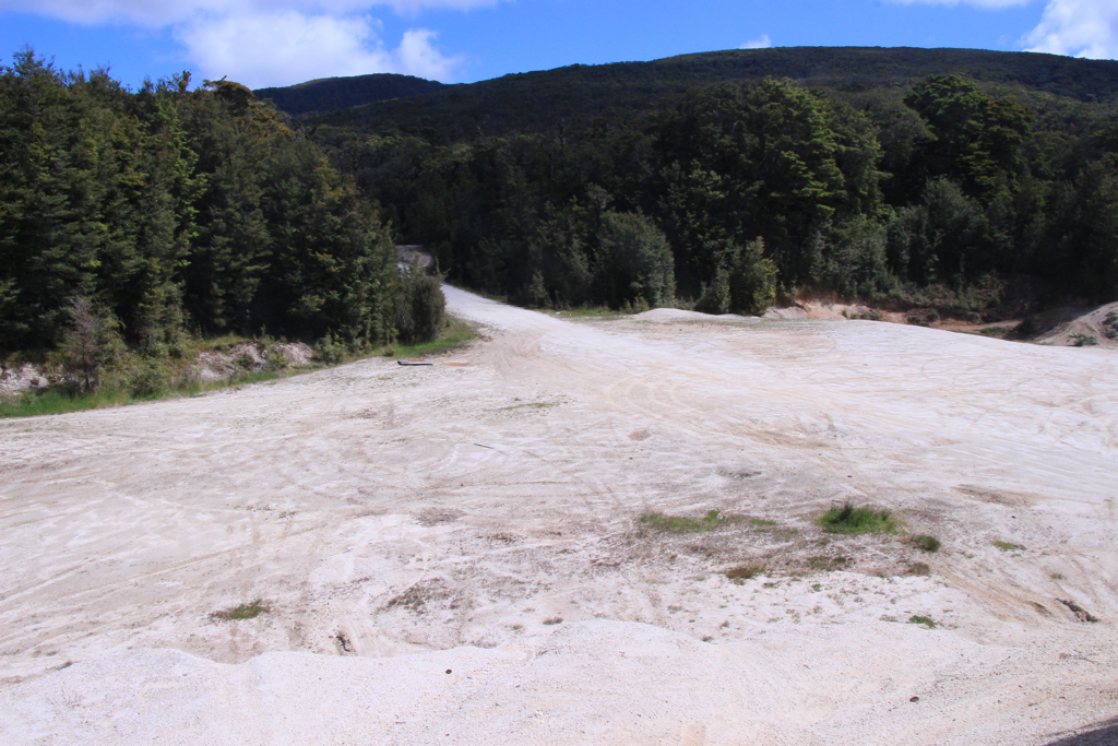 Go up the gravel road on the other side to top of Bald Hill. It was hot and the reflection of sun from the white ground was not my favourite. 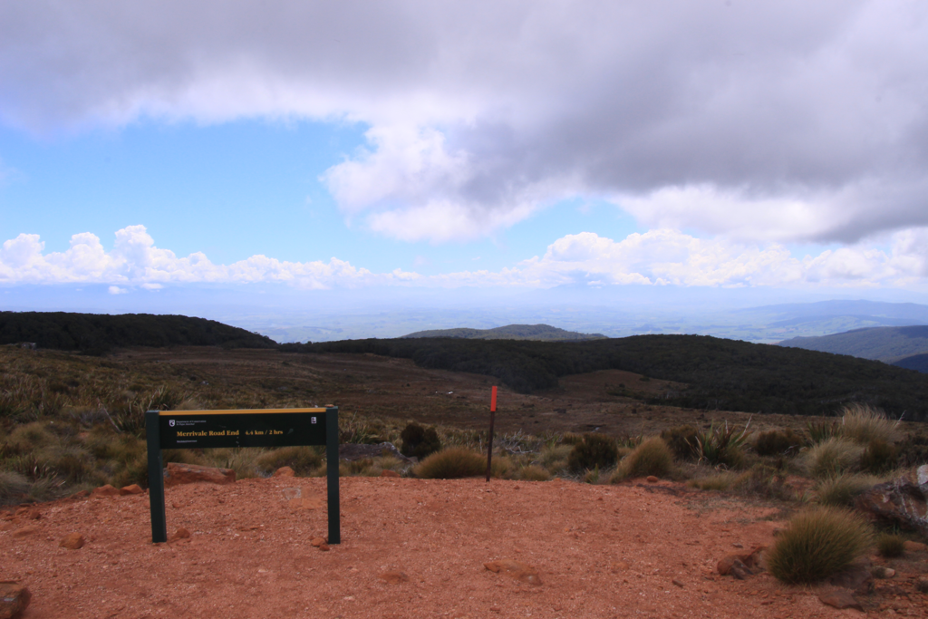 Back to the bush! Follow the poles. The ground is soft again. The soil is horrible at draining water out. 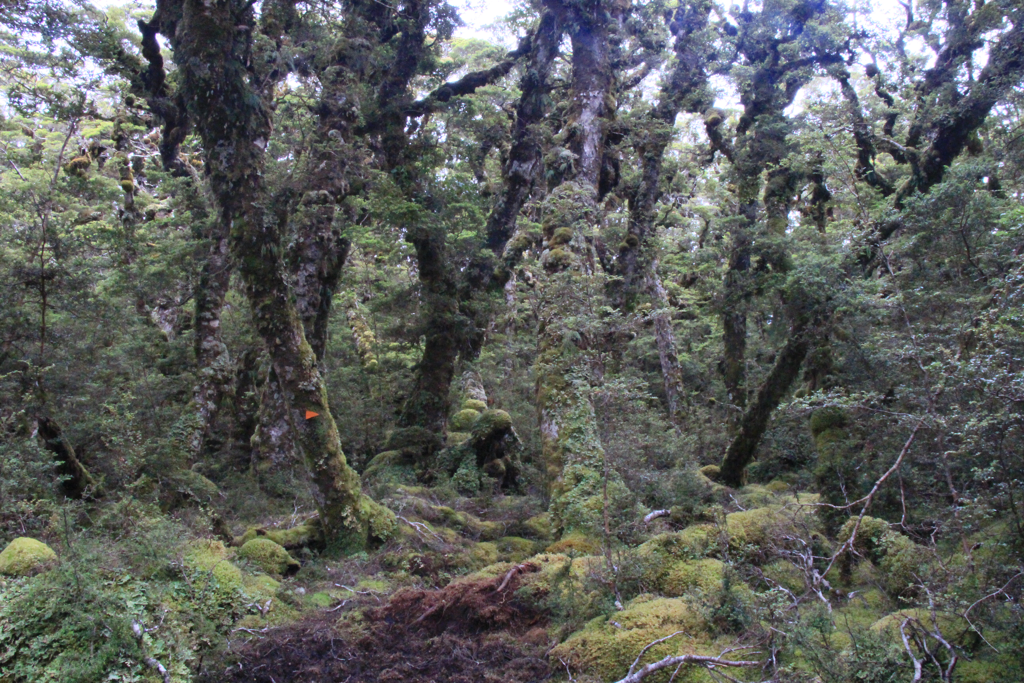 Looks like the dimension has been distorted. Go through the bush for 1.5 hours and there’s a carpark. Follow the gravel road and it switches to the farm road (Marrivale Rd). 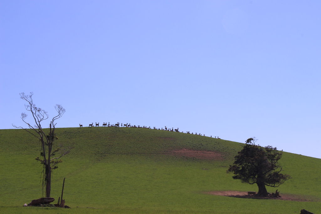 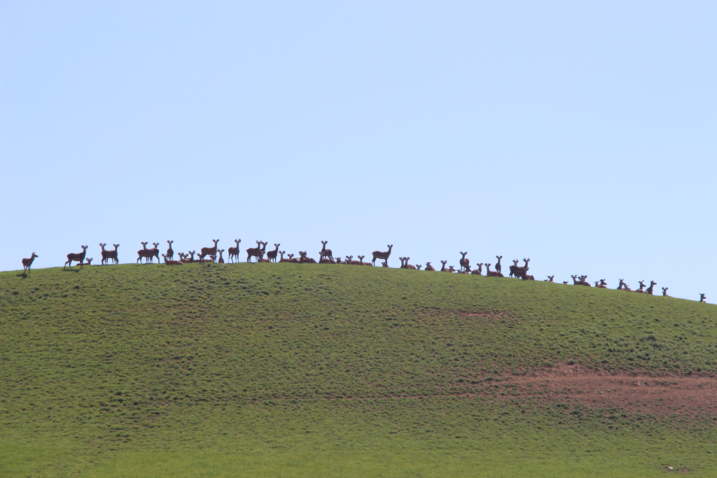 Funny deer. Keep going for another 1.5 hour if not more until you see the end of the road at T section. Just before that there’s Marrivale Hut! Chantel and Daryl are such nice people. The Hut is clean and cozy. The animals are very friendly and the sheep like to be detectives around your belongings. So cute. 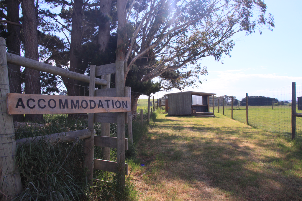 Definitely a nice place to stay. Loved it so much.
Kicked it for the day! Mahuru Cottage to Martins Hut 8 h 13 min 25 km+ 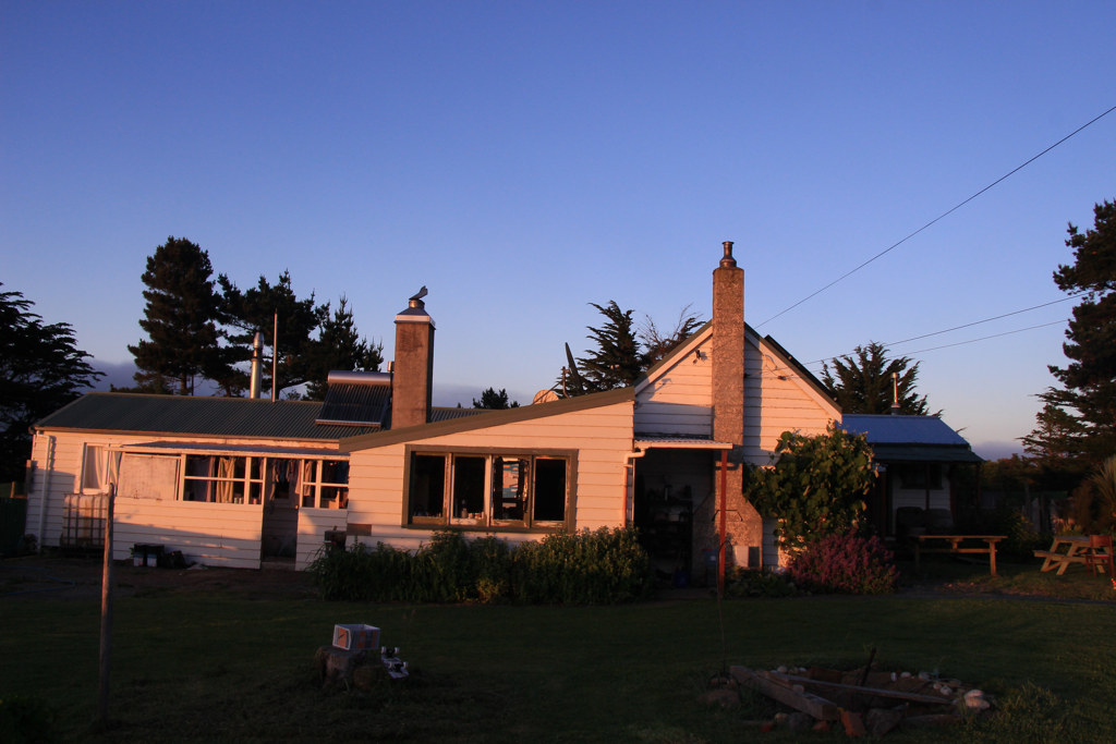 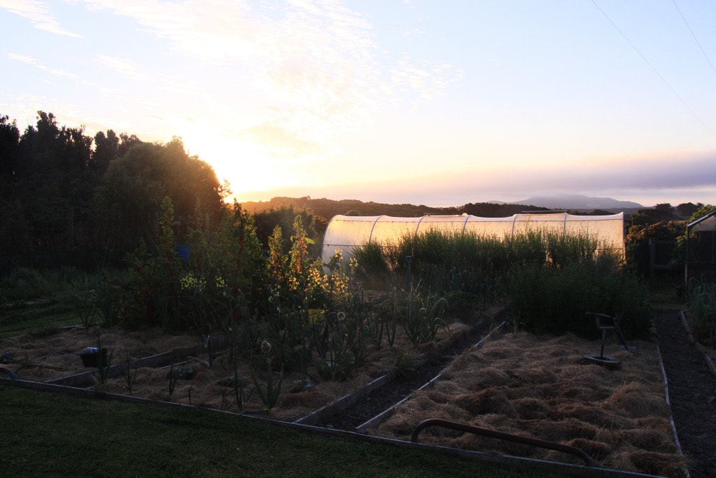 Got up at 5.30 AM with the chickens and birds’ morning call and surprisingly the kids were already awake watching YouTube in the lounge. Had breaky and packed up and got ready to go. It was hard to say bye. Received hugs from everyone. Scott said “The door is open, come back anytime.” I will! I walked off the house. After a while I got lost. And I returned the way. That was a quick come back to see them again haha Then finally I got on the right track after half an hour of detour. How to get to Martin’s Hut from the carpark: Keep walking through the easy bush walk and followed the sign of Cascade Rd (8hrs) to the right. The track gets narrower and wilder but prett well-marked. So just follow them. 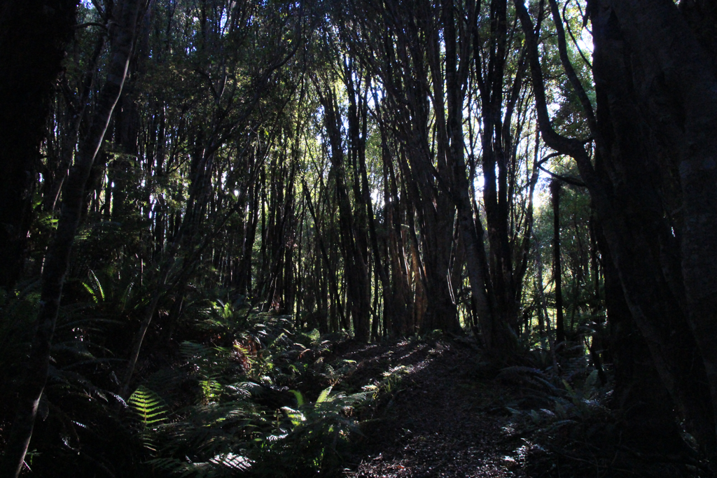 木漏れ日(Komorebi) one of the untranslatable words to English. It means the rays of the sunshine that are filtered through tree leaves. Didn’t really capture it in this photo though. It is winding and flat not much elevation. You can see farm land on your right after one or two hours. I took a break every two hours. Taking of my boots and massage and stretch my feet, treating blisters, taking some energy in and so on are very important. To me two hours is my limit now. If keep walking more, higher risk to trip over myself. 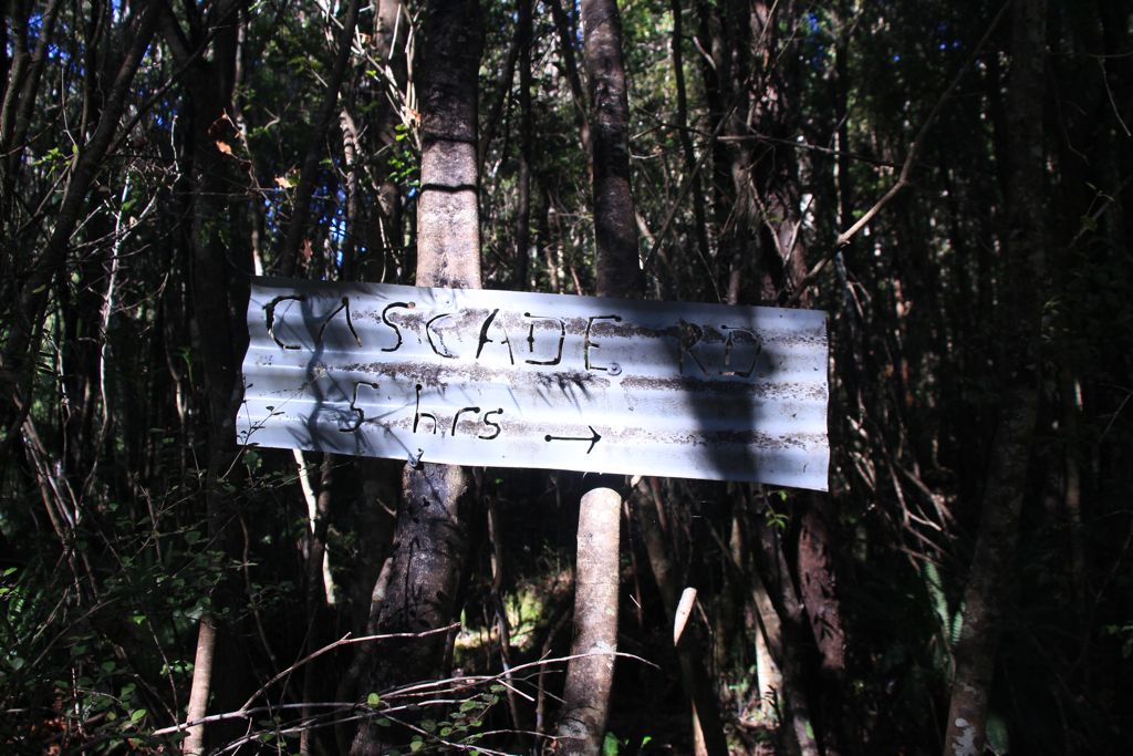 The track changes a bit after this sign. It involves a lot more fallen trees and fallen tracks. This mountain has a history of mining since 1840 (maybe) and there are lots of underground tunnels meshing throughout the mountain beneath the ground. I assume that’s how so many big trees got nocked down and even the ground collapsed. 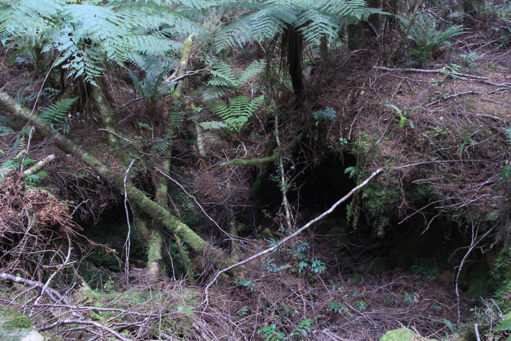 This space should have had a track. There are some places like this. I found it confusing to track the next marker when the track is gone. Take a careful look around you and go around to get back on the track. If you don’t find the marker in a few minutes then you’re mostly off the track so go back to the previous marker and take another possible route. But you won’t get lost as long as you keep following the signs. 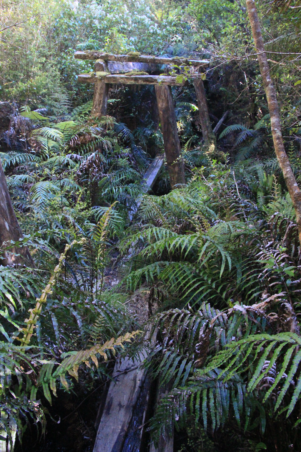 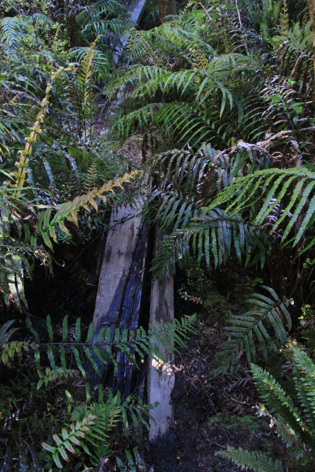 You will find some “bridges” like this. This one is still okay. The other ones are made of a wooden stick. If you don’t have nerves to feel pain, go for it but I went down and climbed back up on the track. Unfortunately, it’s true that there are a few inevitable bridges that you have to cross. 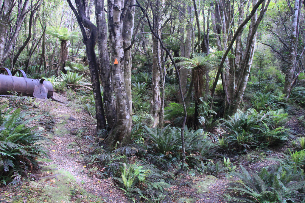 This abandoned metal object on the left is interesting and the sign hardly leads me to take a right. 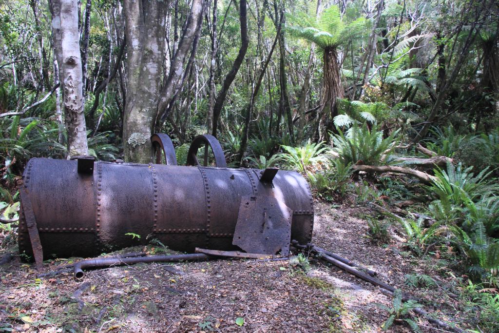 Yeah obviously I took a left/straight attracted by this guy that I saw someone else blog and kept walking through. Wrong way. Turn back and go right. 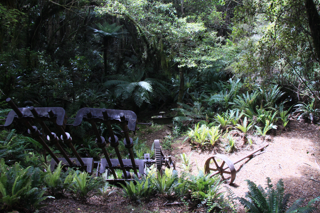 And this huge trolley(?). I don’t know how the Chinese miners could bring these gaiantic metal pieces up here. Mysterious. Maybe they were huge as well. 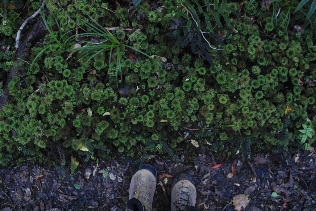 These moss look like flowers. 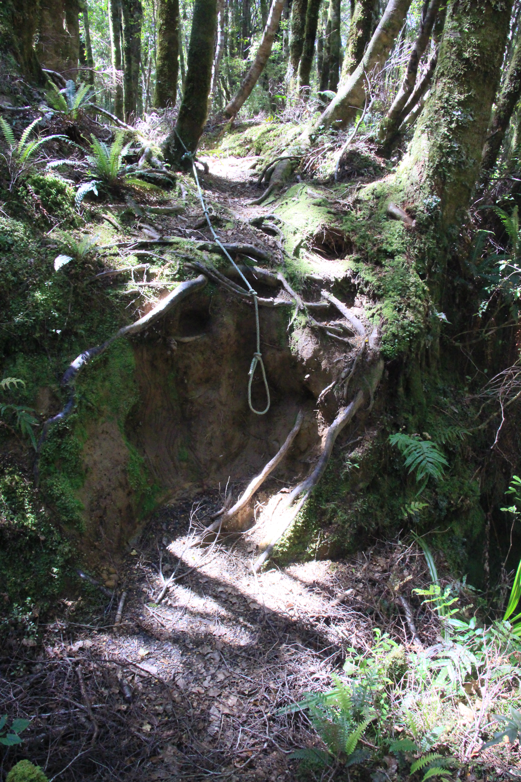 The best tool for tramping. Made my day. After 7 hours of bush walk I got out to Cascade Rd. Take a left going up the gravel road. Follow the sign to Martin’s Hut. Back to the bush and have fun for the steep uphill mud paradise. I don't remeber where but David (the English couple on Day 2) told me he fell in a mud pool until his waist (he is pretty tall). The mud looked like just a normal mud and he stepped in. It was bottomless. According to him, in the Hut book near the mud pool there’s a comment “Who else dropped in the mud?” or something like that. So be careful with muds! 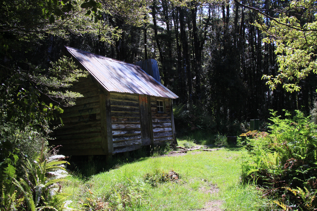 Yay Martin’s Hut! Done for the day!
Riverton Caping Ground to Mahuru Cottage 5 hours 15 km (?) + 10 km (?) hitchhike Sorry I hitched again but I completed the beach walk! Fuck yeah! No more beach walk! No more! I’m done! Woked up ataround 5.40 AM while I was planning to leave at 6 AM. Slept in again. Packed up and left the campsite around 6.30ish.  the sunrise from the campsite was beautiful. I will definitely come back here again. Loved here so much. 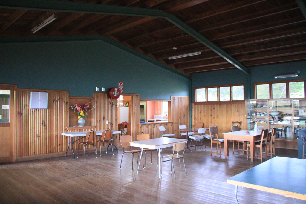 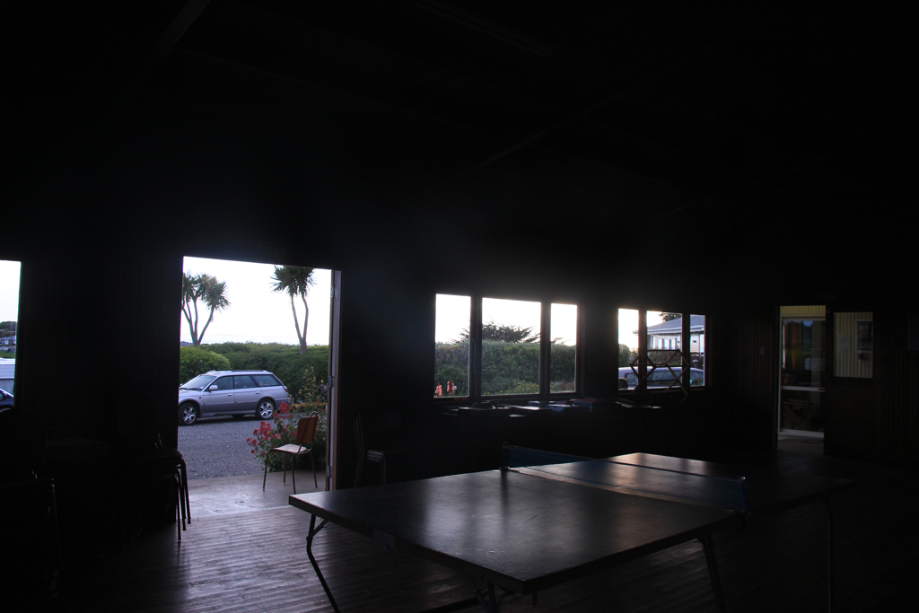 Said bye to the lounge and started waking. The first time bush walk after three days from the start! Finally! Took a little detour accidentally to the Mores Lookout Top rather than straight into Mores Coastal Loop. The track was well marked until I got to the vast farm land spreading along the coast. I wandered around to find the track on the farm about half an hour and eventually did rock climbing because the lock the the gate was too stiff to unlock.  I’m so sick of the smell of these yellow flowers. They were everywhere with other spiky plants through the path between the bush and the farm land.  Started waking on the rocks feeling pretty unsafe. I was praying that an earthquake not to hit around this area. The track was well marked with poles but I lost it at some point mazed on a dangerous cliff. It was impossible to go further than there. So I went back. It was funny that the some people’s footprints were apparently tracking the same route as me and going back like I did. The next pole was hidden in the vegetation on the right farm side, leading me into the farm land again. For a while it became an interesting pole spotting game. Then landed on the beach. Terrifyingly, the sand was softer than the previous one. I couldn’t hold my complains inside me. After about an hour of the nerve-rubbing beach walk I ran out of my water at the same time I got out of there. Then I hitched. 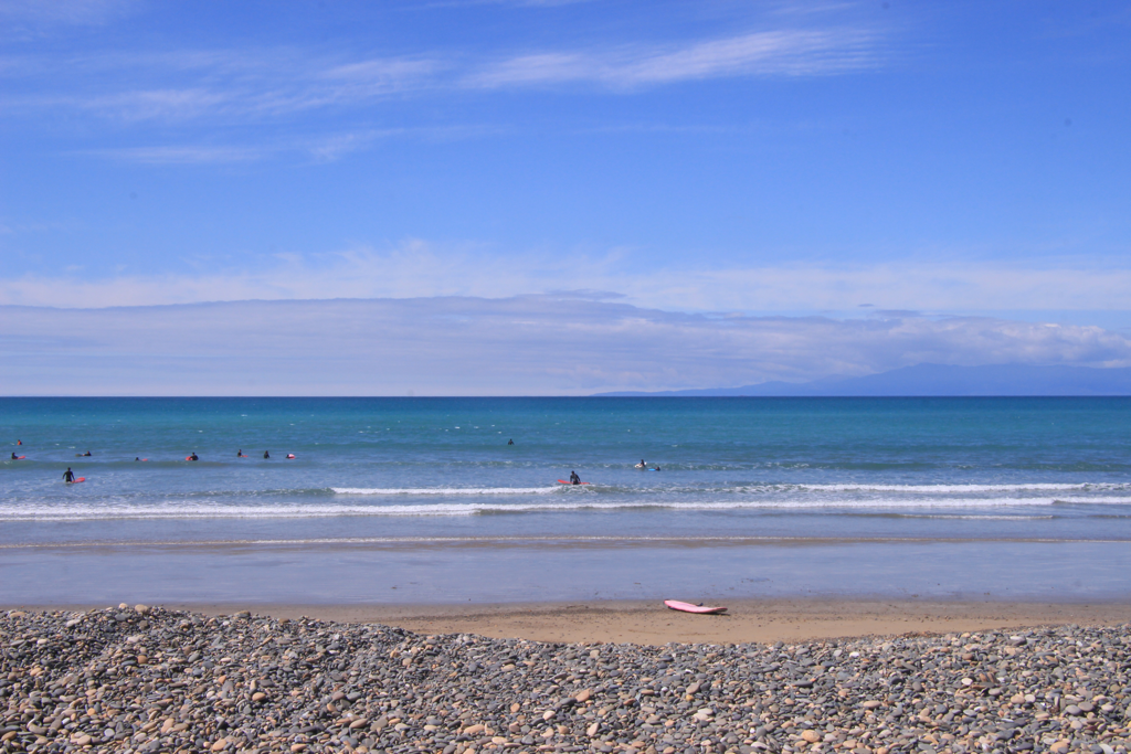 I arrived at Roundhill Rd on which Mahuru Cottage should be. I knocked the window and loudly said hello! but there was no one. He could be still working on his farm as I saw a tractor making lots of smokes and gathering birds on the farm far across the road. It was being not too hot with nice sun and a bit of wind but just perfect to have a nap. After a while, I woke up with the noise of someone walking and he said hey or hi or whatever. His name was Jarod (not exactly sure how to spell) from the States who is walking North Bound in South Island as well. It seems like there’s quite a few people walking NoBo this year. Jarod must be the one with the footprints on the beach because he was closing his eyes walking there! No wonder why he never walked straight. It was almost 1 PM and his destination Martins Hut is 26 km away which would take him about 8 hrs. I didn’t want to stop him anymore. Hopefully we’ll see each other agian at Te Anau. I waited 2 hours there and a first car just came in the road. I could not miss this chance. They were on the way to the carpark where the track starts from and took me to true Mahuru Cottage where was just one or two km up along the road. Super friendly couple! Loved them so much! And yesssss Mahuru Cottage! 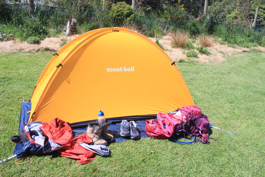 I set up my tent and basically just played with the kids for hours! The owener Scott and Hannah have started having their own vegetable garden and small farm with some sheep, geese, chickens, David the horse and Rosey the rabbit.  Dylan and Maya 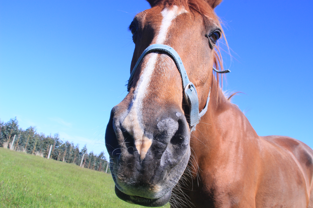 David, he is 22 They were welcoming me for their family dinner with Hannah’s parents. The greens salad from the garden was so good. I finished the half of the bowl’s left over. I need to visit them again. 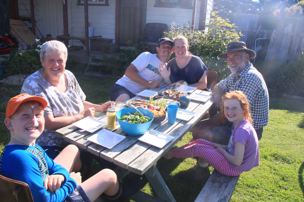 If you want to find a place to stay in Colac Bay, I strongly recommend Mahuru Cottage. There’s a free campsite near the town as well. But I’m really happy that I chose to see this lovely family.  Watched one of the BBC documentary series Planet Earth 2 together after dinner. I didn’t know series 2 was out. The one we watched was about the only fish that uses tool to crack a hard shell of mussel. The fish keeps hitting the shell on the coral using mouth for many many times until it gets cracked. He never gives up. It taught me something important that I don’t learn at university.
That’s all for the day. Next day will be the first tramping for the whole day in Longwood Forest. Invercarfill campsite to Riverton Camping Groud 8 hours 15 minutes 32 km (don’t know exactly) 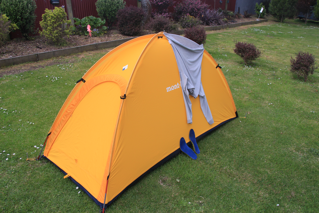 Woke up at 4.45 AM with the alarm on my watch and heard the rain outside which eliminated all my motivation to get up and I went back in my dream again. I jumped up with my eyes fully opened as realise I slept in too much. Left the campsite at 7.50 AM. Got to the start of the beach walk after 2 hours of slow walk as my back and shoulder were aching. 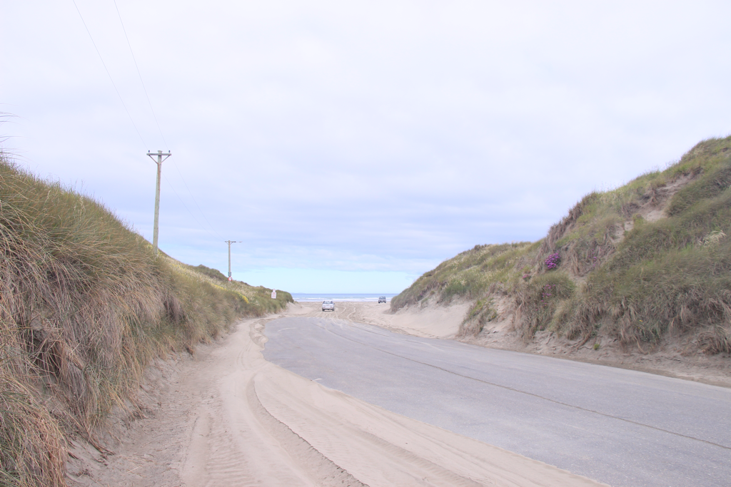 This road part with sands was horrible. It was soft and my feet kept sinking. If you’re walking here as well, don’t hesitate to step in the middle of the road without the sands. So so now the beach walk begins. 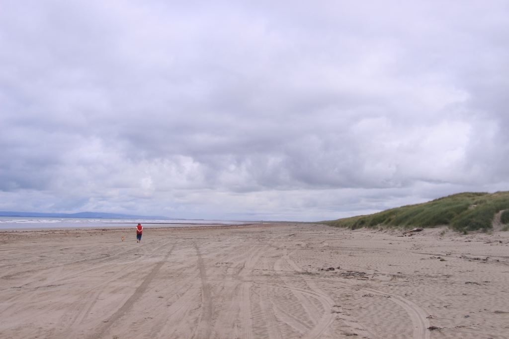 Just keep walking on the beach. It wasn’t too hot. 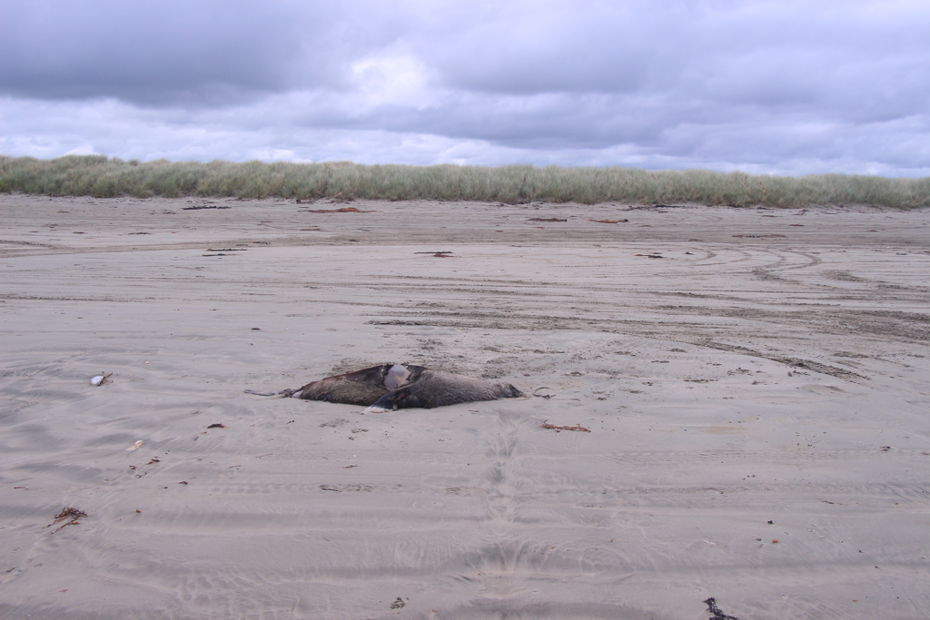 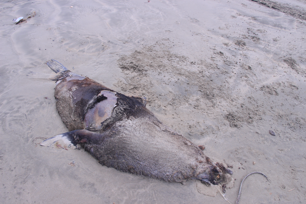 Found this carcass of a seal. And I still keep walking. 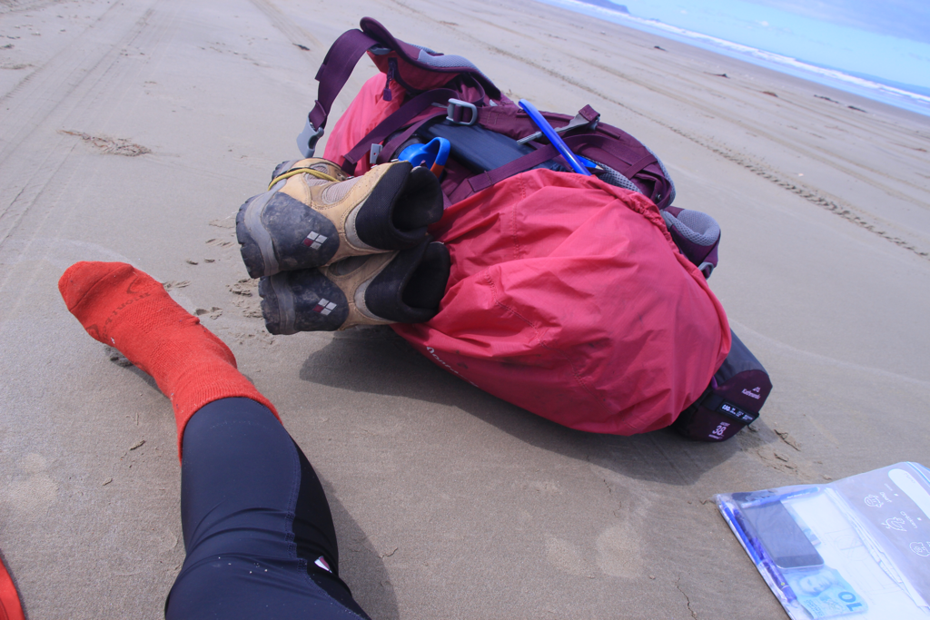 I was getting sick and tired of this beach walk and didn’t know where I was because the scenery never changes there which made mostly impossible to spot on yourself on map. There was very few cars driving through the beach. Absolutely no chance for hitching in the afternoon. The tide was getting higher and closer to me. All I could do is walk. So kept going. 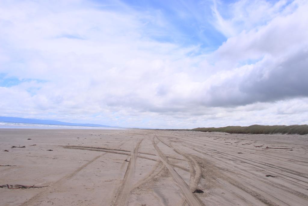 It was getting very hot. Luckily the sand was firm enough to walk normally without my feet sinking in every step. BUT THIS WAS STILL TOO LONG. 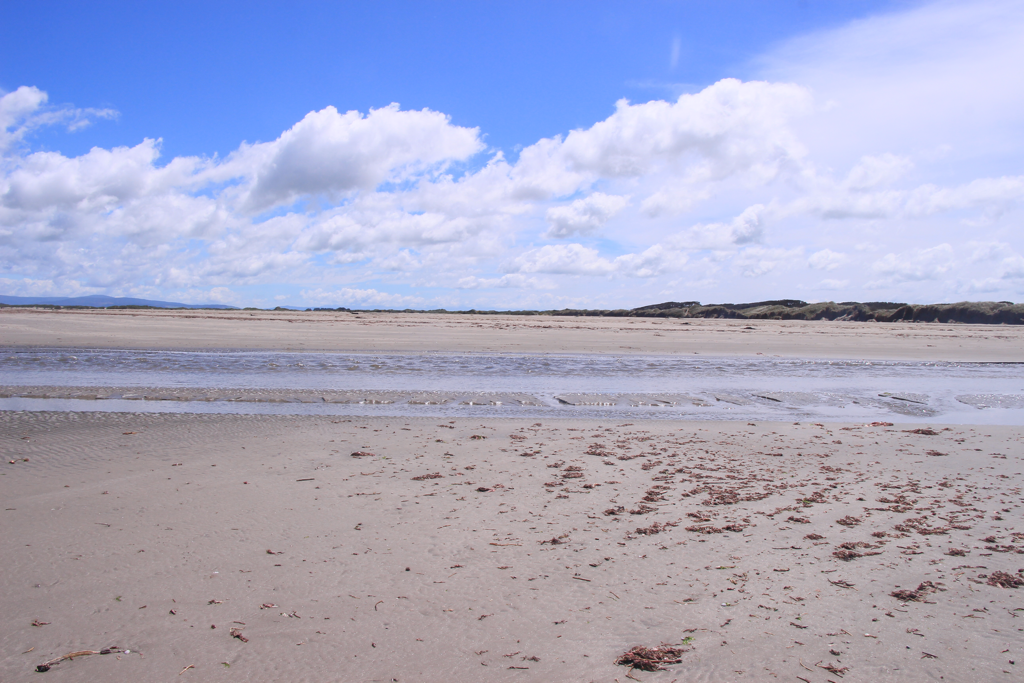 Te Araroa is famous with numerous river crossing involving the trail and I bumped into the first river on the beach. It was kind of exciting to get my shoes wet. But this excitement was merely like a foam washed away by the stream. The shoes got soaked as imagined and full of sands created a small hill under my foot in my each shoe. I should’ve taken them off and gone with bare feet. At this point, it was still about half way. 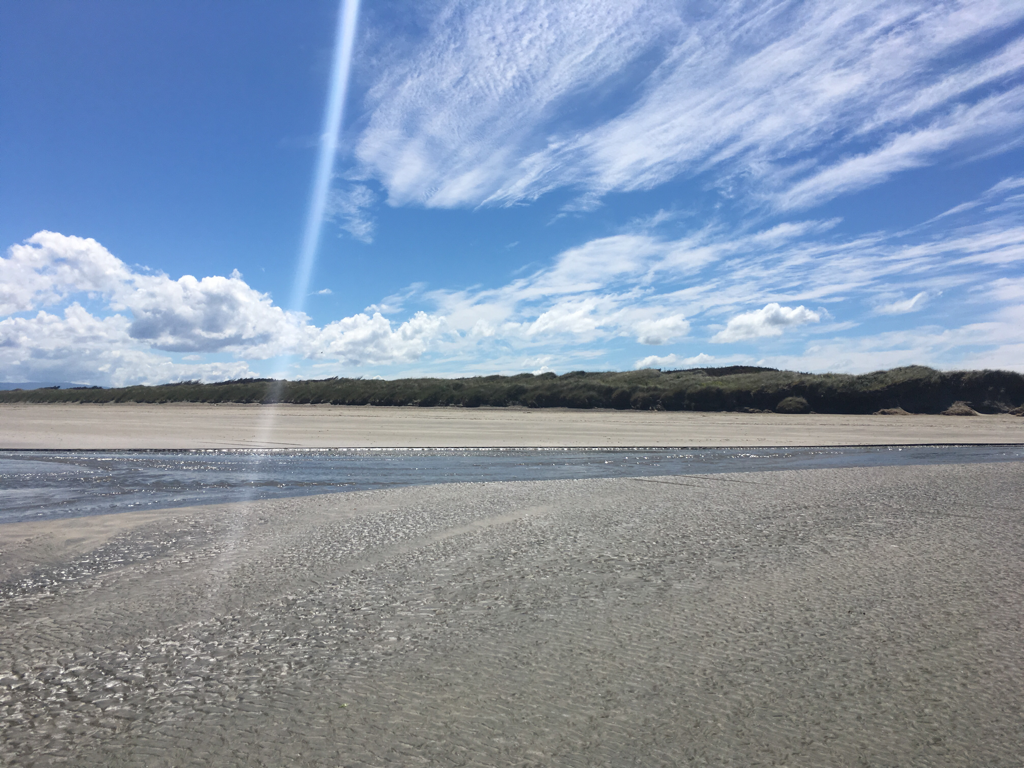 And the second. 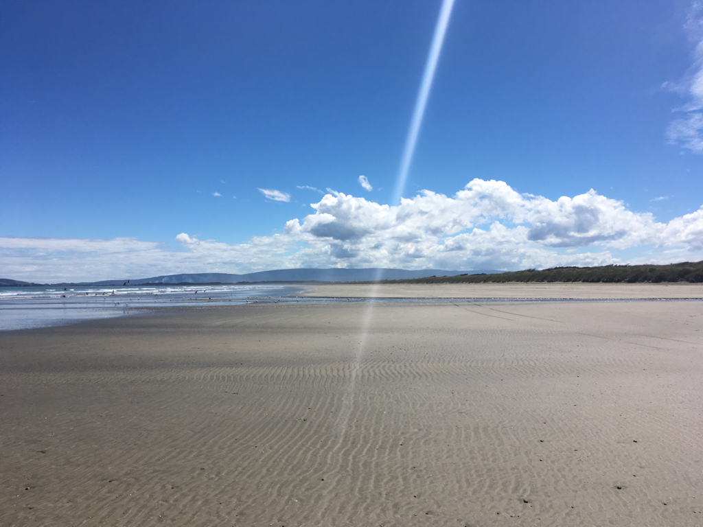 And the third. I was running out of time. But I had to put my shoes on and retreat blisters (plasters and first aid tapes are rubbish against water, no resilience). Then the tide was close enough to catch my bag and camera bag. “Don’t come! Don’t come! No! Nononononono!” I grabbed my camera first and grabbed somewhere my bag and ran away! Only the bag cover got caught it wet and everything else was fine. This moment all of the sudden made me really scared and worried; this huge creature is totally uncontrollable and it’s not gonna care me or my bags, it just does what it does!  And the forth, the last river crossing. There were footprints going ahead of me I found from the middle part and it was fun observing how he (tall she) walked so much like a drunk. It never went straight but winding side by side. The last 5 or 6 Km, I walked like a bullet. Just because being scared of the tide gradually but certainly getting close to me. Then I saw a couple of people on the beach, it made me relieved and saved. They were catching small fish and she said the season’s been lasting for whole this month. She puts the traps on the river in the morning and comes back in the afternoon to collect the fish. And she said there was a man she saw waking on the breach in the morning and when she came back he was already on the other side of the beach. He must have been walking pretty fast then. I said bye to her and kept walking. As soon as I found the “exit” of the 25km of sand world, I took a turn to that no matter where it gets me out. There was a recycle collection area just one or two ks away from the beach. I talked to one of the guys working for the place if there’s anyone who’s going to the town and possible give me a ride. That’s how I ended my day. Holly molly. Hitchhiking is amazing. So I got to Riverton Camping Site in 10 minutes after that! The campsite was super nice, also the people and the guests were super lovely. They give you discount if a TA walker to $10. Can’t compare the one in Invercargill... That one was just at a whole different level (in a bad way). I met an English couple who were walking through South Island from North and they taught me some tips and handy information on the trail. David lectured me how to use a compass to adjust from the magnetic north to the true north on the map or the gridvice versa even getting bitten of sandflies. What the nice people. They said they have done Himalayan hikes together as well. How amazing. Wished that I could spend more time with them to listen to their tramping stories. I also met a Kiwi and an Aussie guy pair who travelled all the way down from Milford Sound by their motorbikes. Cool life! Sounded like having a best moment of their lives after retirement. I met an Asian looking lady from Netherlands with her Duech boyfriend travelling around New Zealand with a cool camping car! She said the tent is very comfy and easy to setup but not very suitable for a windy day. They were hiring the tent about $50ish/day. If you didn’t get a self-contained camping van, this could be your another option! She was really easy to talk to and really nice you know... 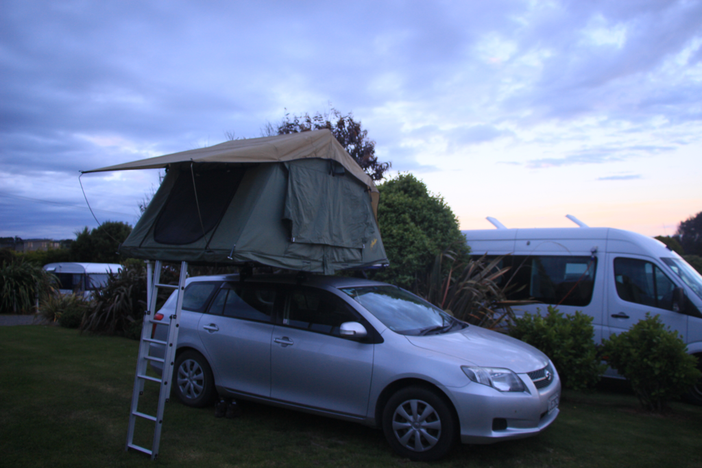 I think that’s all for that day. Phew, long post. Good night.
Bluff Lodge to Central City Camping Park (Invercargill) 10 hours/41 Km Got up at 4.40 AM and left Bluff Lodge at 5.20 AM. After 3 months of planning and preparation, now it’s time to finally step in this. Got to the starting point of Te Araroa, Stirling Point where I cheated visiting yesterday beforehand. The dawn couldn’t be seen due to the weather. It was windy around the coast but way better compare to what we experienced last week in Tararua. I found it a bit boring walking around the peninsula but there’s no other way to go obviously. Well, it was a lie though. So, I walked about one hour and hit to where Beach Walk starts. I walked into the farm like area stepping over the gate as the DoC sign directs but the walk name was covered with a white tape as if they want to say it doesn’t exist anymore. Beyond the gate I couldn’t find any track nor poles. I wondered around a bit and came back to the gate. There was NOTICE from DoC indicating the closure of the track due to the farmer’s complain. Nooooo! I don’t wanna go back! Thought about breaking the rule for a moment but I want to be a good walker, chuck it. It was either
I said bye to Bluff Lodge and started walking on the highway heading to Invercargill. Kept walking the highway in which it was absolutely no fun hours. I think I was just at the middle section of the day, sitting on the bench with a shelter in from of “Museum” and turned on my phone. There was texts from my mom last night and this morning twice and I replied. She immediately responded saying “Please be prepared to hear this, it is about Bucci (our dog back home in Japan).” A flush of a nano second ran through all channels around my head making me notice everything of what she was going to tell me. Still it was very hard to accept and avoid being depressed by the truth. His death was too sudden. I stood up and got back on the track. Just kept stepping forward, step by step. Droplets of tears fell from my eyes with every single of my step. I considered if I could keep on going or quit. My mom used to live this song, “Go on girl” by Ne-Yo, it started singing in my head. I eventually got to Invercargill after 10 hours 42 Km of walking. I don’t know what I’m doing here although it’s clear that I won’t regret choosing this way. Life can end so sudden. I wish I could see Bucci before he goes but it’s too late now. If you have your friends or family situated in a severe condition, don’t wait, just go see them, do what you should. The next life to be gone could be me or you. You never know. Live your life. You only live once. I’m going to walk North.  I will keep loving you Bucci. Thank you for my mom to have decided to adopt him 15 years ago. Thank you for Bucci for being a part of our family and bringing heaps of funny moments. R.I.P Arrived at Invercargill last night. I slept the entire way in the plain. Feel a bit of shame by missing the beautiful landscapes of South Island which can be not easily see from the sky. The weather was fine so there should be high chance to see it without being disturbed by clouds. I got a shuttle bus from the Invercargill Airport to Bluff for $22 which should be reasonably cheaper than taking a taxi. Also I assume there aren’t many people going straight to Bluff thus it was the best way. I was planning to stay on the camping ground at Gregory Street. But they only accept cash while I didn’t have cash and it was $20 pp/night where Bluff Lodge the only hostel here is $20 pp/night as well, I chose Bluff Lodge. The guy running this accommodation is nice and provides pretty much everything you need. There was another girl (maybe from Portugal) staying last night. So only me and her in a big dormitory room. I needed to take a whole day off today because of preparation for the trail hasn’t been completely done yet. I had to send bounce boxes to two places; to Birchwood Station where I will be on the 28th and to Te Anau Post Shop for the rest of the food (rice flour, dehydrated veges etc) that I clearly don’t need for the first week. I also did shopping for grocery and some other essential items to start the trail. I should have everything I need now. Oh, except the insect repellent spray and a gas tin! I’ll get them tomorrow in Invercargill. I flund it funny that I firstly got to Invercargill and even paid for the buss to Bluff but I’m heading to Invercargill again. Anyways, besides the big wave of anxiety and panic was hitting me a couple of days ago, I’m feeling pretty calm and ready to take a first step now. I think I should share my plan for the next 7 or 8 days on the trail here. Finally aye, I know. Day 0 (22nd) Bluff @Bluff Lodge Day 1 (23rd) Bluff to Invercargill ®︎ @camp site Day 2 (24th) Invercargill to Riverton ®︎ @Longwood Holiday Park Day 3 (25th) Riverton to Colac Bay @camp site Day 4 (26th) Colac Bay to Martins Hut Day 5 (27th) Martins Hut to Merrivale Hut (need booking) Day 6 (28th) Merrivale Hut to Birchwood Station ®︎ Day 7 (29th) Birchwood Station to Aparima Hut Day 8 (30th) Aparima Hut to Te Anau ®︎ @hostel *®︎ resupply **@ place to stay if not a Hut  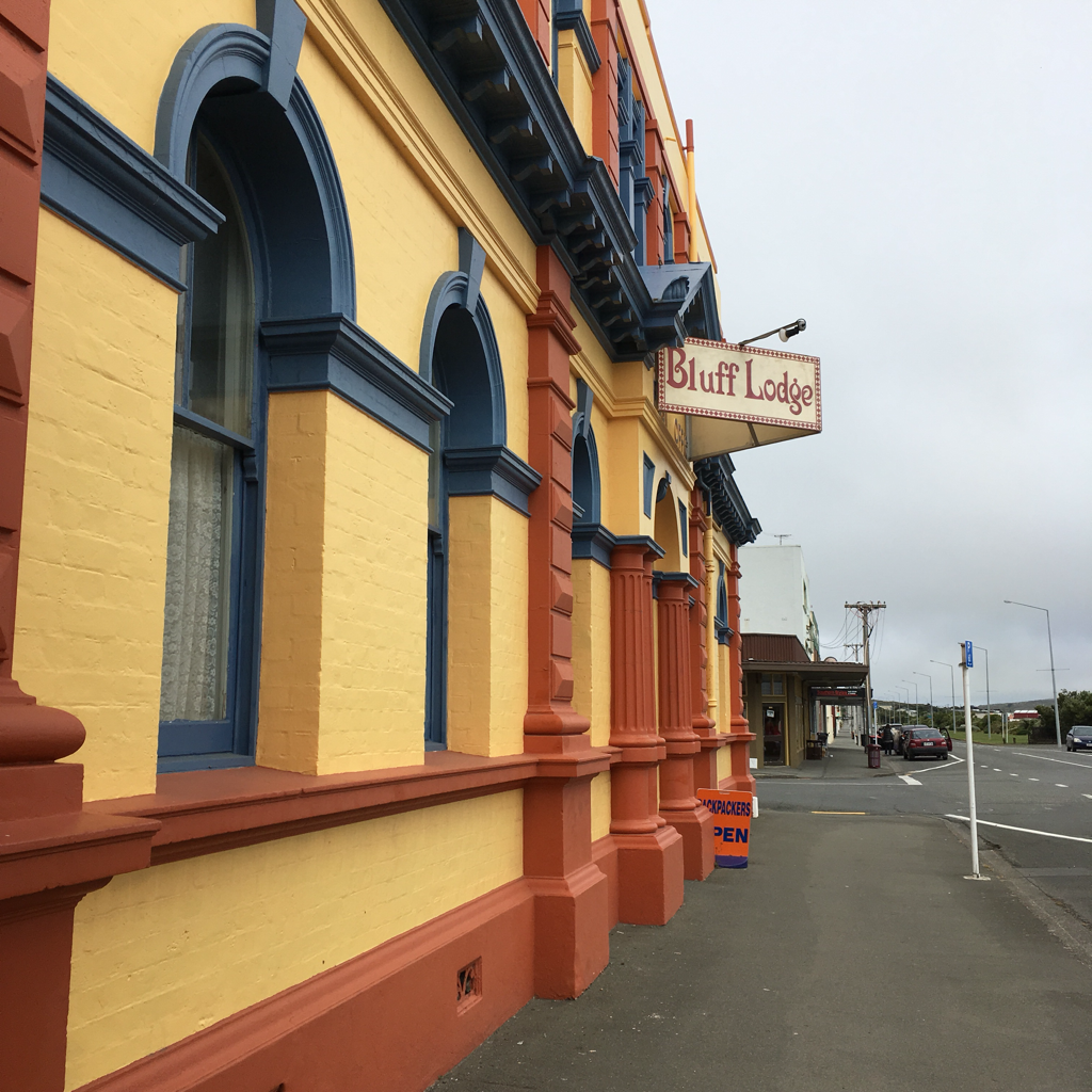 |
